Bunker Hill: The History of an Iconic Hollywood Location

How important is filming on location, rather than at the studio?

The answer lies in the opening scene of a 1960 Paramount film called The Rat Race. Tony Curtis has been playing his saxophone for tips on Midtown Manhattan’s kinetic Times Square. He gathers the coins from his open case on the sidewalk, packs up his horn, and walks around the corner—to Paramount’s “New York” street in Hollywood.

In an instant, the viewer’s suspension of disbelief disappears. You’re stuck on a lousy backlot you’ve seen a hundred times, and you don’t give a damn what happens to Tony Curtis anymore.

The problem is that Times Square is real, and Paramount’s street is phony. Times Square is a random collection of architectural quirks by different builders from different periods of time, haphazardly repaired, visibly cracked and worn down and given an accretion of grime; it’s a chaotic, noisy place where countless people have worked, dreamed, passed by and passed on. Paramount’s street, on the other hand, is a prop, a facade. Tiny details, especially the ones that register just below consciousness, matter when you’re trying to build a world.

Filming in Bunker Hill

This is something all great directors grasp. When many postwar auteurs were looking to make their noir masterpieces, they found their perfect and authentic location in Bunker Hill, a neighborhood of fading Victorians, flophouses, tough bars, stairways and dark alleys in downtown Los Angeles.

A location like Bunker Hill provides its own inherent tension. Consider the Rat Race example. If they are filming in New York, the cast and crew must contend with changing light conditions, traffic, unreliable power sources and disruptive shop owners who feel they haven’t been properly compensated. It’s essential that everyone, especially the actors, get the scene right and move on, because another day of shooting on Times Square requires more city permits and another full day’s pay.

But back at Paramount, filming in “New York,” the cast and crew can spend as much time as they need to properly light the shots without worrying about the time of day. There’s no traffic, no curious pedestrians, no city noise, no permits and no excitement. If Tony Curtis keeps flubbing his lines, they can always come back tomorrow. The anxiety of getting it right the first or second time is gone. That’s why, when the two scenes—one on location, the other on the pristine and placid backlot—are juxtaposed on film, the difference between them is palpable. One has a lived-in feel, and the other is lifeless.

Los Angeles Times film critic Kevin Thomas noted just such a difference when he reviewed a 1966 Glenn Ford detective drama called The Money Trap, which interspersed scenes shot on both Bunker Hill and on MGM’s backlot. The film’s already “tenuous” credibility, Thomas wrote, “is completely undermined by the poor matching of actual Los Angeles locations with some of those old New York street scene sets with the familiar brownstone walkups. How can we accept Ford as a victim of environment—the poor boy who doesn’t quite make good—if we can’t believe in that environment itself ?”

Location vs. Studio

“The tremendous advantages of shooting on location, as opposed to studio, is you’re dealing with reality,” director Peter Bogdanovich says in his DVD commentary for the 1952 film Clash By Night, which was shot in Monterey, California. “It gives an authenticity and verisimilitude, immediately.” As a bonus, “The actors like it because they feel it’s real.” Bogdanovich recalls that Otto Preminger once told him that shooting on location forces a director to be more inventive “because you can’t move the walls.” In other words, unlike a studio designed for the sake of the camera, a real location restricts where that camera, along with the lights and the actors, can go. It challenges the director to try something new.

Veteran cinematographer James Wong Howe agreed. “Artistically, I would always rather be on real sets, on location, in the natural setting versus sets built in a studio,” he told film critic Alain Silver in 1970. “It’s rather ridiculous when you have light from a single source, whether it’s the sun or a solitary candle, and the set is lit so that objects cast three or four shadows. A real house has a ceiling and four walls, and one has to change the way of lighting. In a studio, without a ceiling, it’s easier and faster for a cameraman to light. But to me these are false lights.”

If “authenticity and verisimilitude” seem irrelevant within a theatrical medium, consider that general film audiences are much more literal in their tastes than live theater audiences. They wouldn’t tolerate a movie version of Waiting for Godot with just a cardboard tree on an otherwise empty stage. (In fact, they probably wouldn’t tolerate sitting through Waiting for Godot.) They need the illusion of quotidian reality, especially on the big screen, where actors must overcome the unnaturalness of being oversized creatures formed out of light and shadow.

Consider also that letting in the flow of reality can offset or soften the improbability of oddball characters, farfetched plots and the artificial mood lighting so important to many films. The Christian Science Monitor’s Edwin F. Melvin, reviewing the 1951 film noir Cry Danger, observed that its circuitous story “may not be quite so believable as the realistic photography in some of the less pretentious sections of Los Angeles.”

The January 14, 1951 edition of the Hollywood Reporter praised the film’s director for choosing “to shoot all exterior footage against backgrounds of downtown Los Angeles [and] creating an air of authenticity difficult to capture on celluloid.”

In early 1953, the Los Angeles Times’s Philip K. Scheuer wrote: “Where [The Turning Point] gains the most conviction is from its on-the-spot locations.” The location Scheuer was talking about, of course, was Los Angeles’ Bunker Hill.

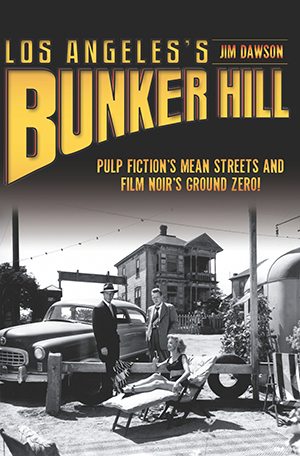
Los Angeles’s Bunker Hill: Pulp Fiction’s Mean Streets and Film Noir’s Ground Zero!

By Jim Dawson

When postwar movie directors went looking for a gritty location to shoot their psychological crime thrillers, they found Bunker Hill, a neighborhood of fading Victorians, flophouses, tough bars, stairways and dark alleys in downtown Los Angeles. Novelist Raymond Chandler had already been there exploring the real-life “mean streets” that his hardboiled detective, Philip Marlowe, prowled in the writer’s exacting prose. But the biggest crime was going on behind the scenes, run by the city’s power elite. And Hollywood just happened to capture it on film. Using nearly eighty photos, writer Jim Dawson enlarges the record of L.A. history with this grassroots investigation of a vanished place.

Before there were steam trains, there were bull trains

In 1876, years before South Dakota would become a state, The Yankton Press and Dakotian reported that “A large party will leave Yankton for the Black Hills. A party from Wisconsin will also leave today and join the Yankton party. The train will consist of some ten or fifteen wagons. The party is well-outfitted and well-armed.” But the train in question wasn’t powered by steam, and it didn’t follow tracks. That technology had not yet reached this part of the future state. Instead, this “train” was a long line of wagons pulled by oxen, one of thousands of bull trains that would haul miners, settlers and ne’er-do-wells needed to survive in that isolated prairie oasis.

In April 1877, the newspaper reported, “The Dakota Central [Railroad] brought three coaches containing two hundred Black Hillers.” Two days later, the same newspaper reported, “About four hundred men arrived on last night’s train from Sioux City, mostly [bound] for the Black Hills.” In its March 5 edition, the newspaper reported, “Thirty men from Dubuque [Iowa] will arrive this week en route to the Black Hills.”

Those men and supplies traveled on bull trains. The bulls, thousands of them in mile-long, meandering trains, had last known civilization in Fort Pierre, two hundred miles to the east. After weeks on the harsh prairie of the Sioux, the exhausted convoys appeared out of the prairie dust, each team of twenty or more oxen pulling sturdy, white-bonneted wagons filled with provisions. Mining and camping equipment—mostly placer pans, shovels, and pickaxes—was gathered up. Rifles were cleaned and pistols were holstered. Information about the overland travel routes was penciled in, and trips were sketched out on the fragile map from the Inter-Ocean News.

Most dream-seekers headed for Deadwood, the spinning hub of the golden excitement; the famous town grew to a population of five thousand almost overnight. It was a lawless place; a gun was judge and jury. Between November 15, 1875, and March 1, 1876, an estimated ten thousand people arrived in the eight thousand square miles of the Black Hills. Five years later, the area’s population would be around twenty thousand, according to the Black Hills Daily Times on February 23, 1884. But the Laramie Treaty soon became a problem.

The Black Hills, and the land over which the miners and other settlers had to travel, did not belong to the United States. Everyone traveling to the Black Hills, and those already in the Black Hills, were trespassing on a sovereign nation’s land and illegally removing its resources. After Custer’s 1874 expedition, this presence of United States citizens in the Black Hills became a problem for the federal government. Try as government forces might, it was impossible to turn back and eject the determined masses clawing and clamoring for gold. For the government to send home those who were already in the Black Hills and to slam the door on those who were on their way was impractical. The hills were like the hub of a gigantic wagon wheel, with supporting spokes all around. The relatively small contingent of soldiers at Fort Laramie, which was more than 150 miles away from the Black Hills, tried to stop the rush, but with a trip of several days between them and the hills and the amount of supplies they would need to maintain a sizeable force there for weeks, it was an impossible task.

There already existed three roads and trails across the Sioux land that had been approved by the tribe in the Laramie Treaty. The treaty also allowed railroad surveyors and construction workers to enter tribal land. Goldseekers were not included on the list of approved visitors, but how could anyone tell one from the other? Perhaps unwittingly, or perhaps because of misunderstandings, the Sioux granted the development of what became three three-mile-wide rights-of-way, which began on the western bank of the Missouri River and crossed their land. Although the treaty denied the United States entry into the Black Hills themselves, the three roads came “near” the forbidden hills. But where could those who traveled the approved roads from Bismarck, Fort Pierre and Yankton, which was known as the Niobrara Route, go after crossing the Sioux land? It was an impossible situation considering the beckoning and constant crescendo of gold.

For the trespassers, the location of the Black Hills in the very center of the Sioux Nation meant they had a long and arduous journey to get to their endowed sanctum. The starting points of the settlers’ journeys, including the three legal eastern roads that were approved in the Laramie Treaty, were located at the four compass points surrounding the Black Hills. The other trails were associated with the parallel continental railroads hundreds of miles to the north and south of the hills. Many goldseekers started their trek from those transcontinental railroads. Others preferred the speed and convenience of taking the train from Sioux City to Yankton and catching a riverboat on the Missouri River to Fort Pierre before heading west on the overland route to Deadwood. Many of these “pilgrims,” as the new arrivals to the hills were called, faced a two-hundred-mile journey over the treaty-approved right-of-way that became the famous Fort Pierre to Deadwood Wagon Trail.

It was by far the shortest route to the Black Hills for the thousands of people, and millions of tons of supplies would soon be pulled by bull train over that challenging, dangerous and deadly road. The road, which was laced with gumbo (sticky mud), became a conveyor belt on wooden wagon wheels that helped keep the Black Hills alive and productive for a decade. By yoking oxen to work in concert with fast horses and muscular mules, settlers were able to carry all the supplies they needed to mine gold and live on the frontier.

The bull trains of oxen that plodded over the Fort Pierre to Deadwood Trail did most of the hard work, hauling hundreds of millions of tons of freight, until eventually the railroad finally punched its way into the hills at Buffalo Gap on the southern slope.

Bull Trains to Deadwood

By Chuck Cecil

Pandemonium wafted up out of Deadwood Gulch whenever bellowing, muddy oxen teams led wagons rattling into town. For a decade, thousands of bull trains hauled all that miners, settlers and ne’er-do-wells needed to survive in that isolated prairie oasis. The bulls, thousands of them in mile-long, meandering trains, had last known civilization in Fort Pierre, two hundred miles to the east. After weeks on the harsh prairie of the Sioux, the exhausted convoys appeared out of the prairie dust, each team of twenty or more oxen pulling sturdy, white-bonneted wagons filled with provisions. Author Chuck Cecil restores the glory of the near-forgotten yet indispensable symbols of the West that made life possible on the frontier’s western fringe.

Chicago Magic: Sleight of Hand in the Windy City

Chicago, that tough midwest city on Lake Michigan, is known for many things, including the meat packing industry, the birthplace of the skyscraper, deep dish pizza, Al Capone, and basketball superstar Michael Jordan. Add one more to that list: magic. Yes, the Windy City makes a strong case for being the hub of twentieth-century magic and home to its share of magicians. Truly, Chicago embraced the community of magicians, extending the welcome mat to card sharps, tricksters, circus freaks, fortune-tellers, and hucksters alike. 

A poster advertising Harry Houdini and his magic show.
Just after the Chicago World’s Fair, Houdini toured as the “King of Cards”
before he gained fame as an escape artist. Lithograph poster, C 1895. McManus-Young Collection, Library of Congress.


Houdini in Chicago

In 1893, an eighteen-year-old from Appleton, Wisconsin, named Harry Houdini arrived at the Chicago World’s Fair to perform. What the small-town kid saw was a wealth of other nationalities and cultures, including Chinese, Turkish, African, and Asian. Playing off the public’s fascination with the “other,” Houdini dazzled crowds who loved their “exotic” magic show. After the World’s Fair, Houdini was in demand. He continued to work in Chicago, sometimes working as many as twenty shows a day, perfecting what would become his signature move — the escape. In 1898, Houdini announced that he would escape from both handcuffs (and a Chicago jail). After summoning the media, Houdini stripped completely naked and was searched before he entered. Local cops put him inside a cabinet. After ten minutes, he walked past the reporters waving his arms, a Chicago legend was born, and the rest of the world demanded their own performances by Houdini.

The Thurston Brothers

Also at the 1893 World’s Fair was Howard Thurston, who worked as a barker for the African Dahomey Village. Thurston stood in front of the attraction and shouted to passersby promising a show with savage, untamed, wild natives performing exotic dances. Magic of this era featured irresistible images of demons, devils, witches, floating skulls and boiling cauldrons, and Howard’s younger brother Harry was inspired to create a dime museum on South State Street featuring all the mysterious and wondrous images from magic’s realm. It was basically a stationary carnival freak show. Ticket revenues helped older brother Howard’s ambitious stage show which featured railroad cars carrying expensive equipment, signs, and assistants. Magic had become a vaudeville staple and a booming business in the early twentieth century.

Harry Blackstone Sr.

Ushering in the so-called Golden Age of Magic was Chicago native Harry Blackstone Sr. From 1910 to 1955, Blackstone carried the traditions of Houdini and Thurston in the twentieth century and inspired generations of future magicians. His elegant stage show was more theater than back alley. Dressed in long black “tails” and top hat, Blackstone also benefitted from a long frame that made him a dashing figure on the vaudeville stage. His magnificent charm and stage personality was enhanced by his innovations, including the vanishing horse and the dancing handkerchief. Easily his most famous bit was his floating light bulb illusion, which today sits in the Smithsonian

Celeste Evans, a female magician in Chicago.
The magical beauty of Celeste Evans and her doves. Courtesy Celeste Evans.


Celeste Evans

Canadian magician Celeste Evans came to Chicago in 1962, during the so-called Golden Age of Magic, and built a career performing on the banquet circuit and at multiple conventions. Evans also became a star of television, appearing at the Palace Theater and on The Ed Sullivan ShowThe Arthur Godfrey Show and To Tell the Truth. Evans shattered the old tradition of the woman in tights working as the magician’s assistants, and even made Chicago mayor Richard J. Daley into a fan. In 1998, she was inducted into the Society of American Magicians Hall of Fame.


“I felt sorry for all those girls who not only had to stand on stage and clap and run little errands, but after the show they would iron the silks and do laundry…They all knew the secrets of the tricks and secrets of the illusions but never performed themselves.”  – Celeste Evans

Chicago Magic: A History of Stagecraft and Spectacle

By David Witter

By the end of America’s “Golden Age of Magic,” Chicago had taken center stage in front of an American audience drawn to the craft by the likes of Harry Houdini and Howard Thurston. Cashing in on a craze that rivaled big-band mania, magic shops and clubs sprang up everywhere across the Windy City, packed in customers and put down roots. Over the last century, for example, Magic, Inc. has outfitted magicians from Harry Blackstone Sr. to Penn and Teller to David Copperfield. Magic was an integral part of Chicago’s culture, from its earliest venture into live television to the card sharps and hucksters lurking in its amusement parks and pool halls. David Witter keeps track of the shell game of Chicago’s fascinating magic history from its vaudeville circuit to its contemporary resurgence.

The time Abraham Lincoln visited a Virginia battlefield

Abraham Lincoln famously spent much of his presidency traveling. He went to Antietam to issue the Emancipation Proclamation and to Pennsylvania for the famed Gettysburg Address.

But it’s less known that Lincoln took other, more dangerous trips — to the fresh battlefields of Virginia, where he met with wounded soldiers both Union and Confederate and quizzed his generals. There, Lincoln could hear the sounds of cannon fire. He could also see the cost of war.

An important site

As the war began to wind down, Lincoln’s top general, Ulysses S. Grant, set up his headquarters at City Point, Virginia, a town located at the junction of the James and Appomattox Rivers. By water, it was within easy reach of Fort Monroe and Washington, D.C.

City Point quickly became the scene of the greatest logistical operation of the Civil War. Railroads and telegraph lines were installed to link the Union armies in the field. It became not only the supply depot of the Army of the Potomac but the nerve center as well — and a massive hospital to boot.

On June 20, 1864, Lincoln embarked on a wartime mission to City Point. Mr. Lincoln left Washington at 5:00 p.m. on the USS Baltimore. He took Tad and Assistant Secretary Gustavus Fox with him. The purpose was to meet with General Grant and briefly visit the army on the James River.

The Baltimore arrived at City Point at about noon. Grant and his staff boarded the ship. Mr. Lincoln had health problems, “an upset stomach.” Someone suggested a sip of champagne might help. With his keen wit, the President replied, “No thanks. Too many fellows get seasick ashore from drinking that very stuff.”

Lincoln and Grant

Lincoln's top general, Ulysses S. Grant, with his wife and son.
General U.S. Grant with his wife and his son, Jesse, at City Point. Library of Congress.

Lincoln rested briefly and then went to Grant’s headquarters. There he mounted the general’s horse, Cincinnati, one of Grant’s favorites. The President visited some of the troops in the lines near Petersburg. Grant rode his other horse, Jeff Davis. Mr. Lincoln also reviewed some of the black troops under General Edward Hincks. He received hearty cheers.

The evening was most memorable. Lincoln and Grant relaxed, sitting in front of the headquarters tent swapping stories. The President and his commanding general had a good relationship. He held Grant in high esteem. Lincoln once said that Grant was one of the few generals who never criticized him or blamed others for military problems. He fought and took the blame and shared the glory with others.

A great opportunity was missed by Mathew Brady. He had arrived in the area and was but eight miles away taking pictures of various generals, unaware that President Lincoln was visiting General Grant.

“The men”

City Point, the Virginia battlefield that Lincoln visited.
City Point, 1865. Library of Congress.

A few days later, the President and General Grant steamed up the James River to observe troop positions and visit the flagship of Rear Admiral Lee. En route, they picked up General Benjamin Butler at Bermuda Hundred and went up the river as far as it was considered safe. Then Lincoln departed on board the USS Baltimore for Washington. The group arrived at the Navy Yard at 5:00 p.m. the next day.

It was a memorable trip for Lincoln, and City Point would remain an important site for the rest of the war. Lincoln would visit it several more times, with his last trip coming in April 1865 — less than a week before he was assassinated.

Each time, the president confronted the price of war. During one visit, on which he was accompanied by his wife, Mary, Lincoln went to the Depot Field Hospital. Chief Medical Officer Edward B. Dalton met the President and invited him to tour the facilities. Lincoln declined, saying he wanted to see the troops. The President said, “Gentlemen, you know better than I how to conduct these hospitals, but I have come here to take by the hand the men.”

Lincoln’s Wartime Tours from Washington, D.C.

By John W. Schildt

Abraham Lincoln spent much of his presidency traveling. His visits to Antietam to issue the Emancipation Proclamation and to Pennsylvania for the famed Gettysburg Address are well remembered. During the course of the war, Lincoln also traveled to West Point and Harpers Ferry. As hostilities drew to a close, he spent time on the Virginia battlefields, from Petersburg to Richmond and beyond. In this new edition of Lincoln’s Wartime Travels, John W. Schildt details visits to wounded soldiers both Union and Confederate, conferences with generals and the logistics of getting a wartime president from place to place.

Lincoln’s Springfield Neighborhood

By Bonnie E. Paull & Richard E. Hart, Foreword by Dr. Wayne C. Temple

When an emotional Abraham Lincoln took leave of his Springfield neighbors, never to return, his moving tribute to the town and its people reflected their profound influence on the newly elected president. His old neighborhood still stands today as a National Historic Site. The story of the life Lincoln and his family built there returns to us through the careful work of authors Bonnie E. Paull and Richard E. Hart. Journey back in time and meet this diverse but harmonious community as it participated in the business of everyday living while gradually playing a larger role on the national stage.

Meet Tristan Smith, Author of “A History Lover’s Guide to Houston”

Houston, that huge yet friendly city on the Gulf Coast, isn’t exactly known looking in the rearview mirror. In fact, history can be a tough sell even to native Houstonians (yes, they exist). Tristan Smith is trying to fix that. As a transplant to Space City, Smith reveals the town’s historic treasures and exceptional heritage of innovation, industry, and architecture. “A History Lover’s Guide to Houston” is his follow-up to “Images of America: Houston Fire Department,” published in 2015. 

How long have you been in Houston?

I moved to Houston in August of 2011 from Lawrence, Kansas. 


What is your opinion of Houston’s historic preservation community?

I think that Houston has a strong historic preservation community. I came from a city where both the city government and the historic preservation community viewed the preservation of its history, historic buildings and their environs as a high priority. Of course, there were disagreements, some setbacks, but the relationship between the two was fairly strong. That’s a much easier balance to find in a much smaller city.


Are there any specific preservation projects that excite you?

I think more can be done in Freedmen’s Town, but the historic restoration development that is taking place at and around the Rutherford B. H. Yates Home is a great start.


What’s your favorite Houston building?

The Astrodome. How could it not be? Outside of that, La Carafe was a favorite the moment I saw it. 


What building would you like to bring back from the past?

The Shamrock is one that I would like to see as I never had a chance to visit it. I am also a big baseball fan, so I would have to add old Buff Stadium in there as well. 


Who, from Houston’s past, would you like to meet?

Julia Ideson would have been a fascinating person to sit down and talk to. 


Houston is such a forward-looking city, how do you frame its history with that in mind?

I really think you can only look forward to the future by embracing your past. The path Houston takes to get to the point of being the home of NASA and “Space City” is rooted in its history with the turning basin, the proximity to the coast, the politics of the city and state, oil and gas, transportation, etc. We’ve been on the cutting edge for over a century…knowing where you came from (good, bad and ugly) is important in moving forward.


What role does nostalgia play in your work and love of Houston history?

My Houston-centric nostalgia doesn’t play as much a part here as it would have back in Lawrence or Kansas City, where I grew up. I think, in general, a lot of my love of history is rooted in some form of nostalgia. My emotional and nostalgic ties to events and buildings here in Houston are still forming somewhat. There is a feeling, though, of “dang, I wish I could have walked through that building before they tore it down” or “I wish I had a chance to see a ballgame at The Astrodome”. 


Do you gravitate more towards the architectural significance of structures or the societal histories they can recall?

I love the architectural significance of structures and understand their significance to the landscape of the city’s history. The process of design, realization, the connection between the architect’s artistry and nuances to a style are extremely important and interesting to me. However, personally, I gravitate to the societal histories of buildings. I like imagining the sounds, the smells, the traffic, the conversations, the business, the life that passed through a building. 


Any follow-up book ideas?

I am currently at work on a book that will look at a more state-wide series of historic locations. I think there are many opportunities for stories to tell in Houston and throughout Texas. 

A History Lover’s Guide to Houston

By Tristan Smith

Houston earned its international reputation as a hub for space flight and the oil industry. But visitors don’t need to search out the secrets of the stars or the depths of the earth to experience the impressive legacy of the nation’s fourth-largest city. Traverse the streets of downtown and find historic treasures from antebellum Texas. Venture to the outskirts to find the world’s “Eighth Wonder,” as well as the globe’s tallest stone monument and one of its largest ports. Discover why the town’s exceptional heritage of innovation, industry and architecture has sparked a movement to uncover and embrace its historic structures. Join Tristan Smith for an in-depth exploration of Houston’s historic wards.

Disaster and Recovery: The Great Virginia Flood of 1870

Natural disasters are unavoidable; but it’s a community’s response to catastrophe that changes and, hopefully, improves over time. When a flood ravaged Virginia in 1870, it inspired a humanitarian response and revealed the limits of local government’s willingness and ability to help its poorest citizens.


“To the ear it sounded as if the elements were holding a concert on the grandest scale of musical combinations. The pattering and silvery tinkle of the millions of rain-drops—the trickling and murmur of thousands of rills—the babbling and splashing of the streams—the roar of the innumerable cataracts, and the sullen, deep, and subdued sounds of the mighty flood and the breaking waves all united in a chorus, that can neither be described nor conceived of in its solemn grandeur.”—Virginia Gazette, October 7, 1870


Disaster Strikes

After a long, dry summer, on September 28, 1870, the western part of Virginia witnessed the end of their drought. Not only did the region’s farmers rely on rain for irrigation, but industries including mills and iron furnaces needed running rivers for power. Additionally, shipping and transportation along the inland waterways and canals depended on sufficient water levels. What started as a light rain quickly developed into a massive storm that hung over the region from Wednesday through Friday. The downpour converted the waterways into sweeping torrents. The normally peaceful veins of water became cutting scythes of unstoppable power as the rain brought death, destruction, and economic loss to families and communities that were in the path of the rushing water. Locals sought higher ground, waiting on rooftops or climbing to treetops. Countless were lost.


“Poor women and children were on the streets who had just escaped a watery grave, and every few minutes a low rumble would be heard, the startling signal that one of their once happy homes had sunk beneath the waters together with all their earthly possessions, or perhaps containing loved kindred and friends, whose dying wails could be heard on the midnight air. At intervals all through the night buildings were being swept away.—At one time we heard four fall in less than five minutes.” — Eyewitness at Virginius Island

An engraving of the Great Virginia Flood.
Engraving of the flood at Harpers Ferry. Notice the train crossing the bridge across the Potomac. If you look closely, you can also see all manner of things happening in the water. From Harper’s Weekly, October 20, 1870. Scan from original.

Most of the damage took place near the veins of travel. Once into West Virginia, the flooding continued along a mainly rural path through Jefferson County before reaching the industrialized city of Harpers Ferry, which became the scene of so much death and destruction that it forever left a mark on the town. Where the Shenandoah River meets the Potomac at Harpers Ferry, the flood’s path of destruction turned toward Washington, D.C., sending waves of debris down the river and toward the bridges and shores of Georgetown, Washington and Northern Virginia, finally calming as the river widened and the terrain flattened. 

Disaster Relief

What happened to the survivors? What relief did they receive? The First Baptist Church was one of two evangelical churches in Lynchburg that encouraged the wealthy members of their congregations to treat laboring whites as “moral and spiritual equals.” Flood victims were represented, but only after newspapers ran their stories. Virginia’s official plan for relief grew out of an appeal published four days after the flood by John D. Imboden, who publicly appealed for relief in the New York Herald. He sought to bundle donations from organizations in New York City and send them directly to the Virginia governor’s office. Six days after the Imboden letter was published in the New York Herald, Governor Walker called for the Virginia legislature to organize a joint committee to collect and distribute aid, public pressure helped the cause too. 

“The Valley of Virginia is ravaged as cruelly as though fire and sword had once more visited it; along the James and the Potomac, there is such distress as has not been since the dark days of the rebellion. A calamity like this should be the means of showing that we know no political differences in the presence of distress. The Quaker’s formula of “How much do you sympathize with them?” will suit the present case admirably, and before many days are over, ought to find a response from the wealth and commerce of this State such as will convince Virginia how truly we sympathize with her in this hour of deep misfortune.”  — The New York Times


The Virginia Legislative Relief Committee was composed of three senators and five representatives chosen from areas most affected by the flood. Three weeks after the waters abated, the official plan called for localities around the state to set up relief committees to solicit donations. 

A drawing of St. Charles Hotel in the aftermath of the Great Virginia Flood.
The St. Charles Hotel was once a landmark in Richmond. The building was torn down in the late 1890s in order to construct Main Street Station. Engraving from Frank Leslie’s Illustrated Newspaper, October 22, 1870. Scanned from original.

Legacy

None of the victims could rely on flood insurance, social aid programs and official policies for dealing with disasters, so commonplace today. At the time of the The Great Virginia Flood of 1870, permanent federal aid programs or professionally organized relief groups didn’t exist, and it would be another 19 years before the Red Cross was formed. Sadder still, it would be another 108 years before the Federal Emergency Management Agency (FEMA) came into being.

The Great Virginia Flood of 1870

By Paula F. Green

In the fall of 1870, a massive flood engulfed parts of Virginia, West Virginia and Maryland. What began near Charlottesville as welcome rain at the end of a drought-plagued summer quickly turned into a downpour as it moved west and then north through the Shenandoah Valley. The James, Shenandoah and Potomac Rivers rose, and flooding washed out fields, farms and entire towns. The impact was immense in terms of destruction, casualties and depth of water. The only warning that Richmond, downriver from the worst of the storm, had of the wall of water bearing down on it was a telegram. In this account, public historian Paula Green details not only the flood but also the process of recovery in an era before modern relief programs.