
Typically, historians have keen researching instincts, insatiable curiosity, and shrewd detective skills in their skill set. Now, add scuba diving to that list. As it turns out, Georgia is home to dozens of historic sites, all underwater! In the twentieth century, rural communities sought ways to join the electrified world. The U.S. Army Corps of Engineers, Tennessee Valley Authority, and Georgia Power brought hydroelectric dams to rivers, lighting up the entire region, but at a price. Dozens of communities were sacrificed so that others might prosper. Georgia’s new lakes hid the mark of their original sin under the waves. And curiously, North Georgia never had lakes before they were created from this very modern act of intentional flooding.
“[The Tennessee Valley Authority seeks] to improve the navigability and to provide for the flood control of the Tennessee River; to provide for reforestation and the proper use of marginallands in the Tennessee Valley; to provide for the agricultural and industrial development of said valley; to provide for the national defense by the creation of a corporation for the operation of Government properties at and near Muscle Shoals in the State of Alabama, and for other purposes.” — Tennessee Valley Authority Act, 1933
Etowah
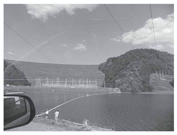
Allatoona Lake in Bartow County hides the former town of Etowah, Georgia, a once-thriving industrial town with an iron works at center of Georgia industry. Before the Civil War, thus center of Georgia industry had two thousand people contained a rolling mill, a flour mill, a carpenter shop, a foundry, spike and nail mills, a hotel and workers’ homes. The U.S. Army Corps of Engineers began working on the Allatoona Dam project in 1941, and was completed in 1949, the dam was complete, and the waters began pouring into Etowah. The town was not salvaged, but Etowah had its graveyard was relocated out of respect. A single monument on the grounds of old Etowah is Cooper’s Furnace along the Etowah River behind Allatoona Dam mark the ghost town.

Related: John Muir’s 1867 Thousand-Mile Walk to the North Carolina Gulf
Tallulah Falls
Dubbed the “Niagara Falls of Georgia,” this marvel of nature along the Tallulah River boasted a series of four main cascades and several smaller rapids, dropping 350 feet over a mile’s distance. Despite its robust tourism industry in the early years of the twentieth century, the lure of that much surging water power was irresistible to electric companies feeding a booming Atlanta. Tallulah Falls Lake became a 63-acre reservoir with 3.6 miles of shoreline, and connected the Tallulah River with Lake Burton followed by Lake Seed, Lake Rabun, Tallulah Falls Lake, Lake Tugalo and Lake Yonah.
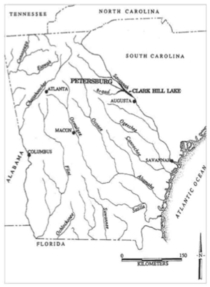
Where Petersburg is located. Courtesy of Rita Elliot, “The Pulse of Petersburg.” Image sourced from Underwater Ghost Towns of North Georgia.
Petersburg
There was some strategy to drowning a town. Whenever possible, engineers and politicians chose communities that were dying or already dead. Take Petersburg, which had prospered in the late eighteenth century until commerce changed. Once Georgia’s third-largest city, Petersburg, along the Savannah River, had paved streets, several schools, a newspaper and a prosperous population. When its tobacco industry moved away by the 1850s, the town was doomed. 100 years later, J. Strom Thurmond Lake lay on top of it.
The Coosawattee Valley
The Coosawattee Valley was once home to the Cherokee Nation capitol, and the area remained remote and natural until the early 1970s when an ambitious project arrived. The US Army Corps of Engineers set its sights on the Coosawattee River and began the impoundment by building Carters Dam, creating Georgia’s deepest reservoir at the brand new Carters Lake. Electricity was not the only by-product of this project — flood control was also on the menu. The Coosawattee once carried runoff from 376 square miles of watershed into the flatlands of northeast Calhoun or “The Great Valley.”
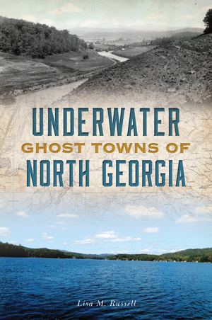
Eager to learn more? Check out Underwater Ghost Towns of North Georgia and other related titles at arcadiapublishing.com!

